
フラっとインフラ 公共施設インフラ写真集 English
ページ内目次
フラっとインフラ 公共施設インフラ写真集
We, Hokkaido Regional Development Bureau and Development and Construction Department are engaged in many social infrastructure projects in order to create a livable community.
This booklet consists of brief explanation and pictures, for the purpose of introducing the role of social infrastructure and promoting the public understanding.
Please feel free to visit these places with this booklet on a weekend, so that you can see how it works to our daily lives.
This booklet consists of brief explanation and pictures, for the purpose of introducing the role of social infrastructure and promoting the public understanding.
Please feel free to visit these places with this booklet on a weekend, so that you can see how it works to our daily lives.

-
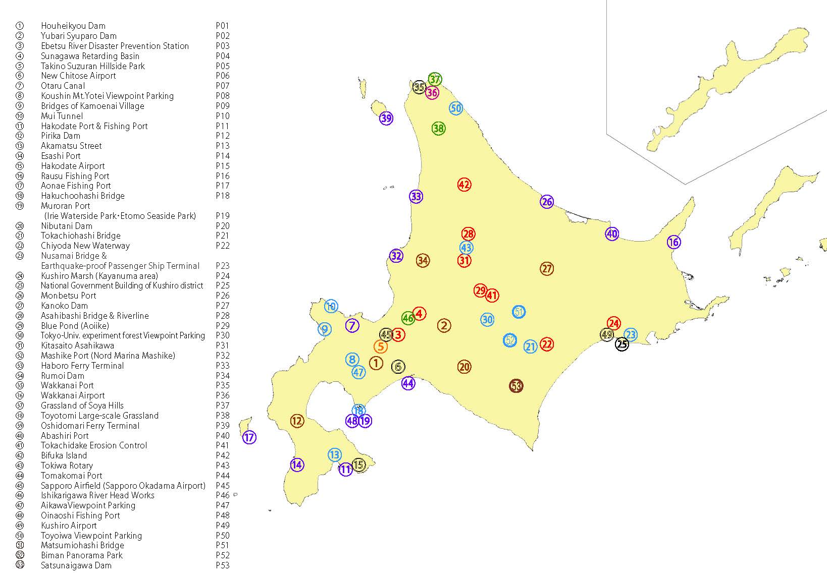
 Map of Infrastructure
-
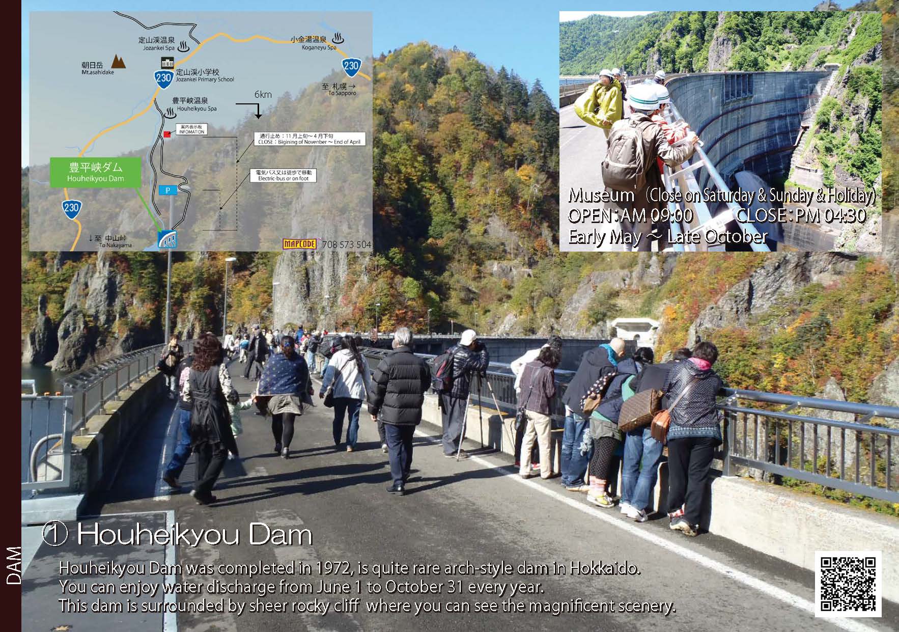
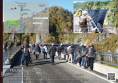 1.Houheikyou dam
-
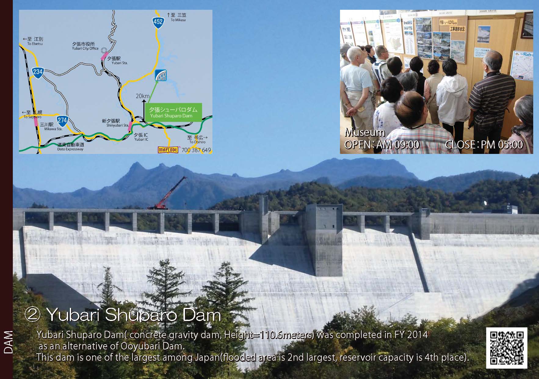
 2.Yubari Syuparo Dam
-
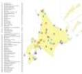
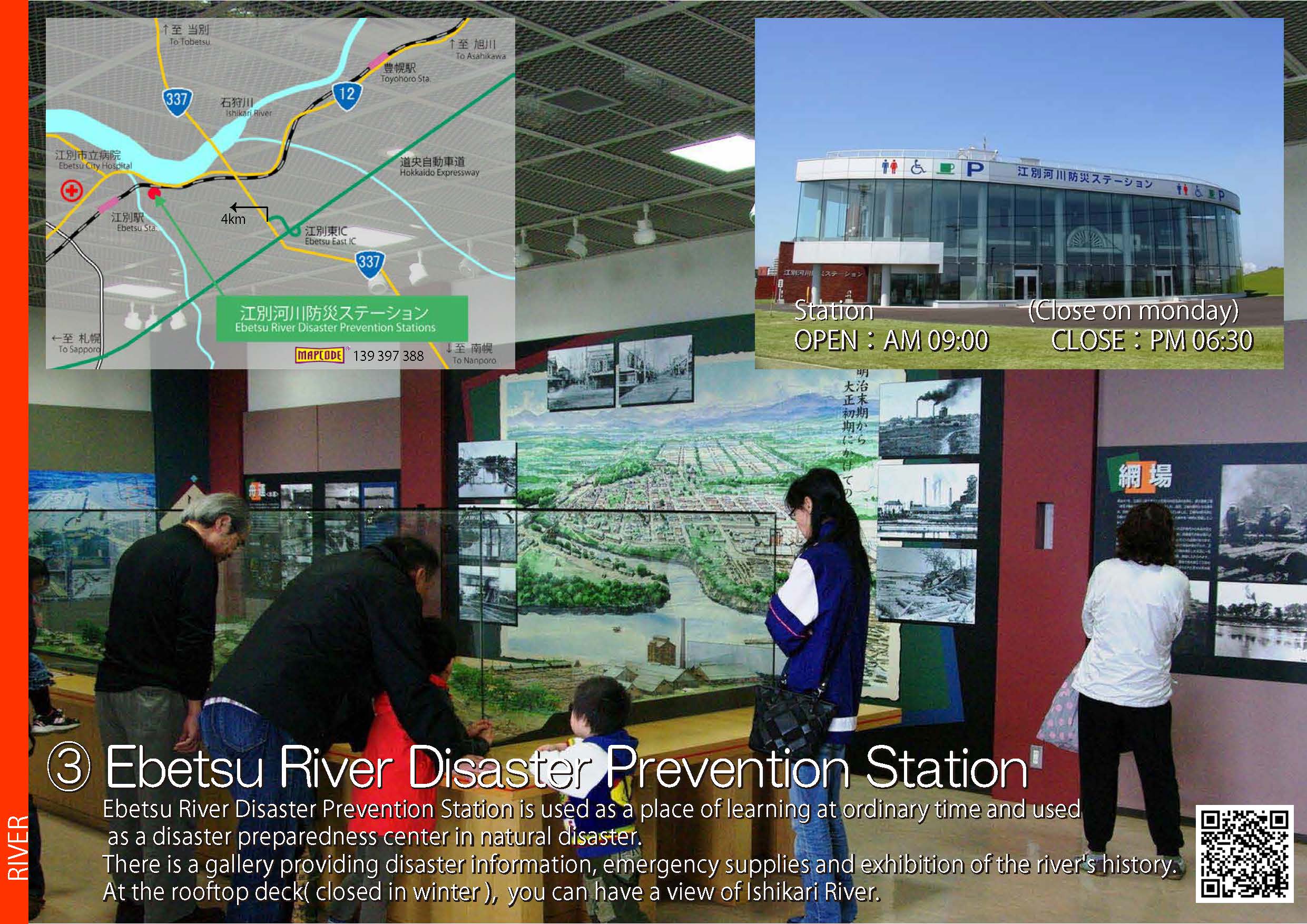
 3.Ebetsu River Disaster Prevention Station
-
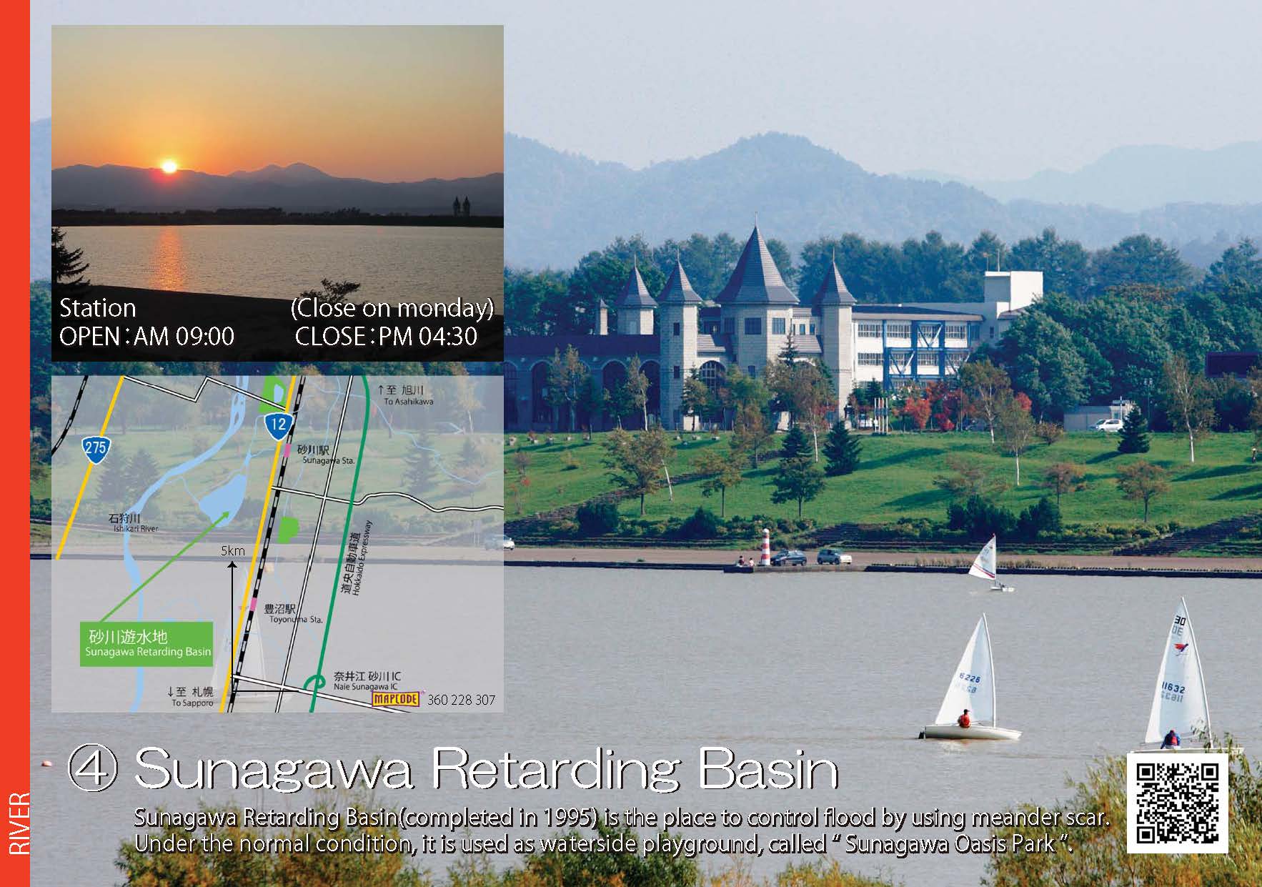
 4.Sunagawa Retarding Basin
- Map of Infrastructure (JPG:170KB)
- 1.Houheikyou dam (JPG:316KB)
- 2.Yubari Syuparo Dam (JPG:223KB)
- 3.Ebetsu River Disaster Prevention Station (JPG:452KB)
- 4.Sunagawa Retarding Basin (JPG:226KB)
-
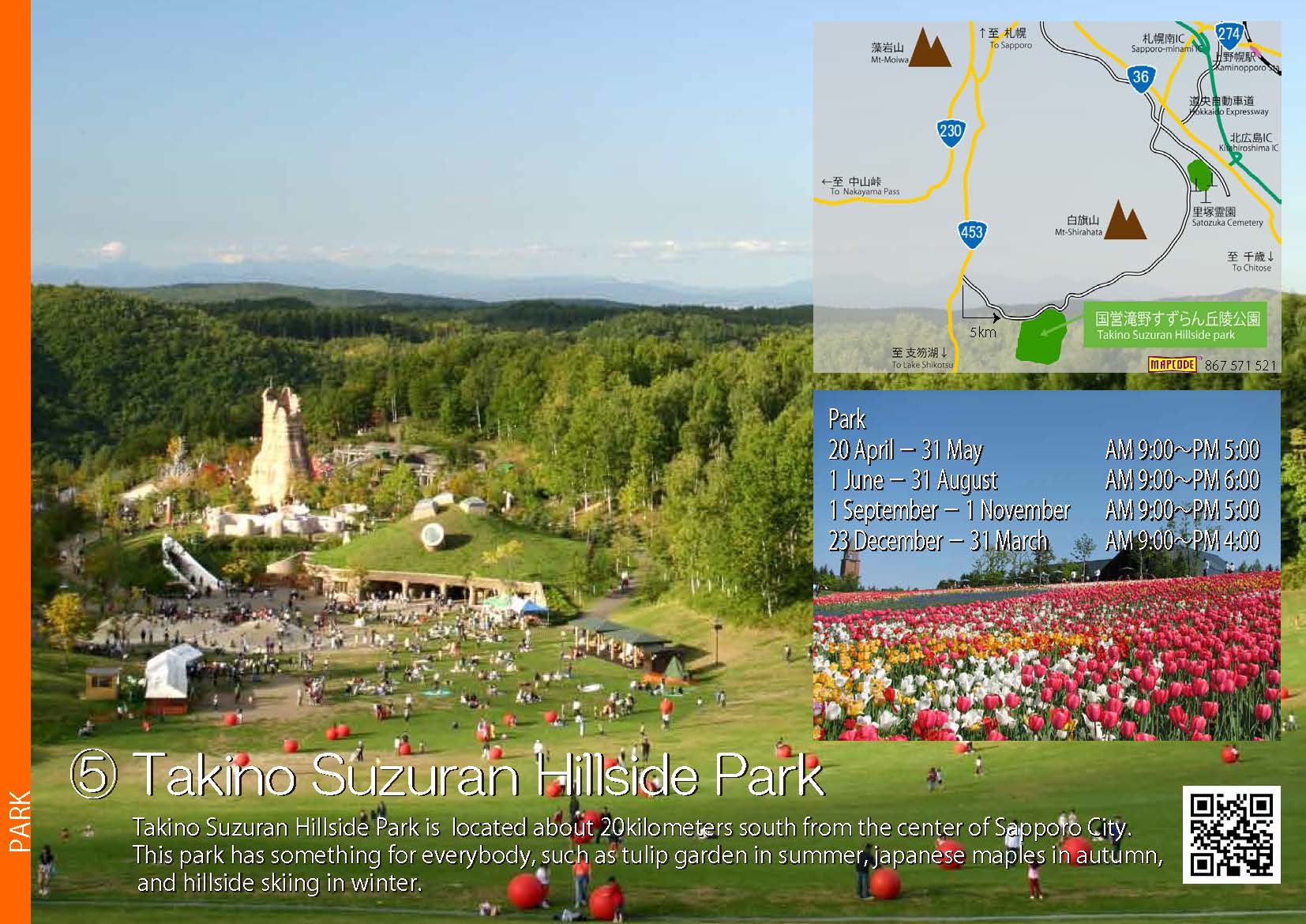
 5.Takino Suzuran Hillside Park
-
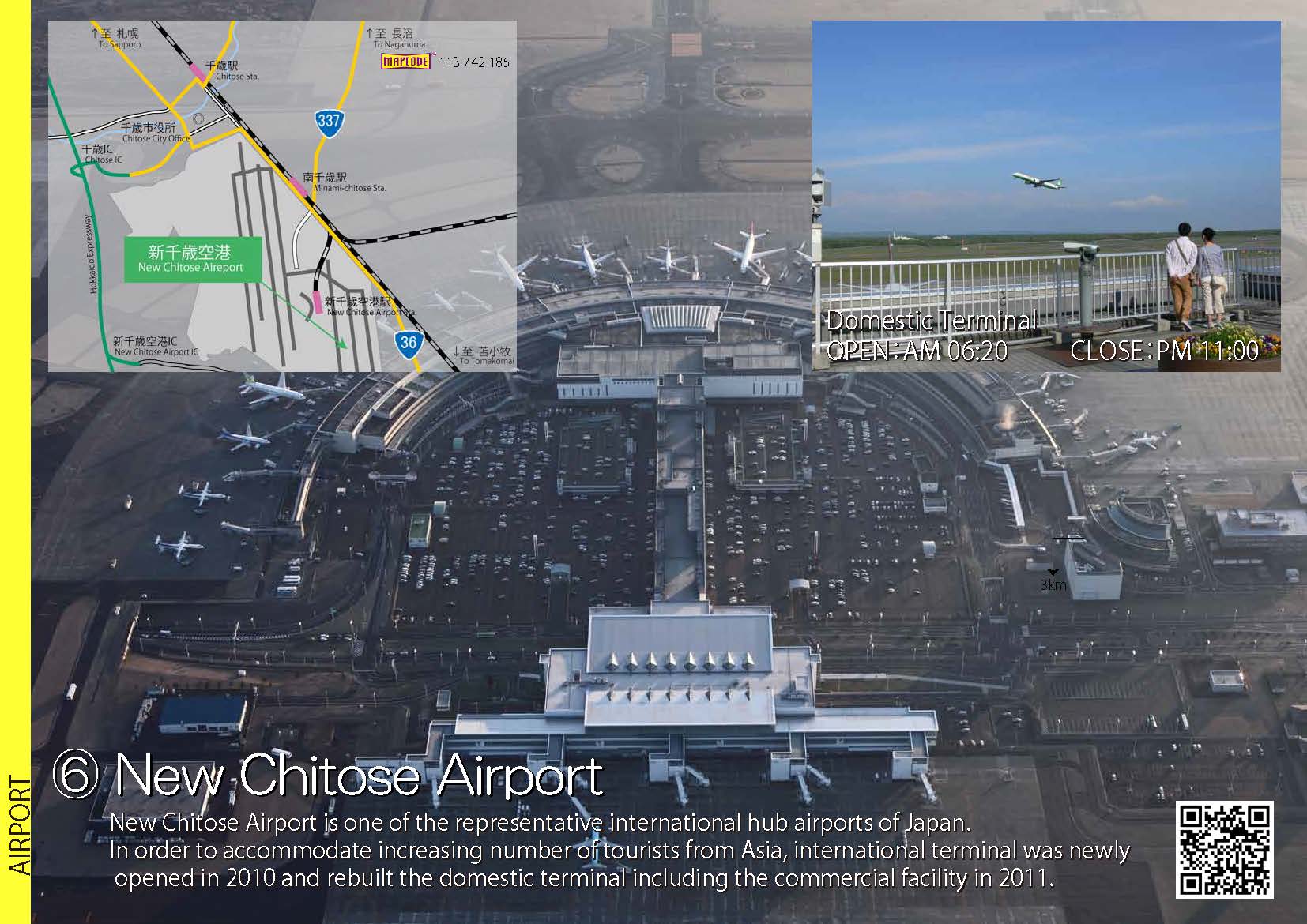
 6.New Chitose Airport
-
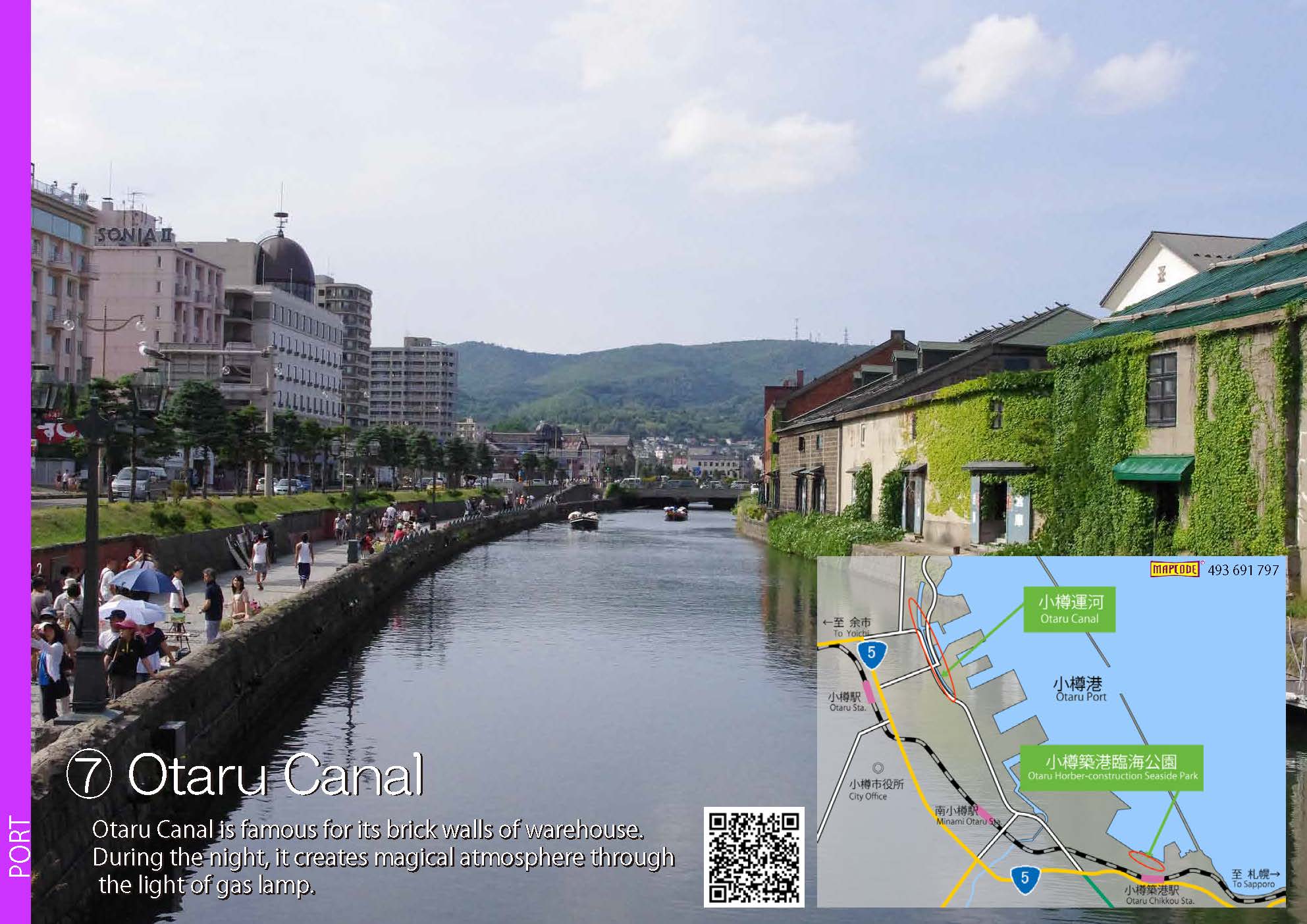
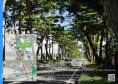
 7.Otaru Canal
-
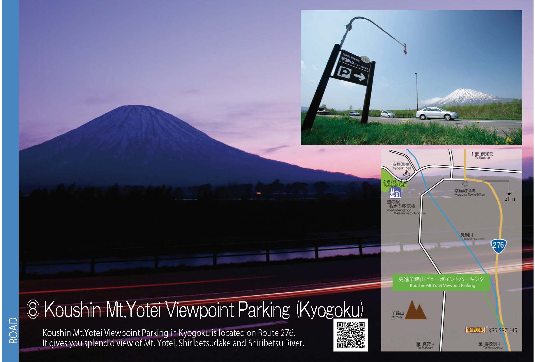
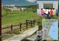
 8.Koushin Mt.Yotei Viewpoint Parking
-
 9.Bridges of Kamoenai Village
- 5.Takino Suzuran Hillside Park (JPG:237KB)
- 6.New Chitose Airport (JPG:212KB)
- 7.Otaru Canal (JPG:263KB)
- 8.Koushin Mt.Yotei Viewpoint Parking (JPG:146KB)
- 9.Bridges of Kamoenai Village (JPG:229KB)
-
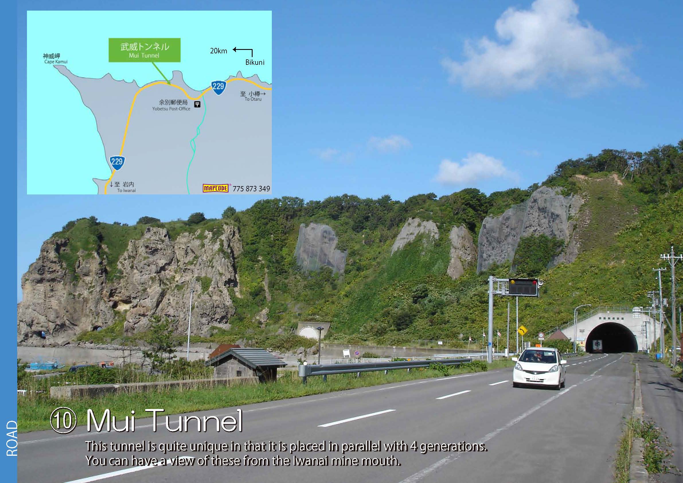
 10.Mui Tunnel
-
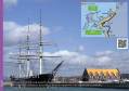
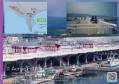
 11.Hakodate Port & Fishing Port
-
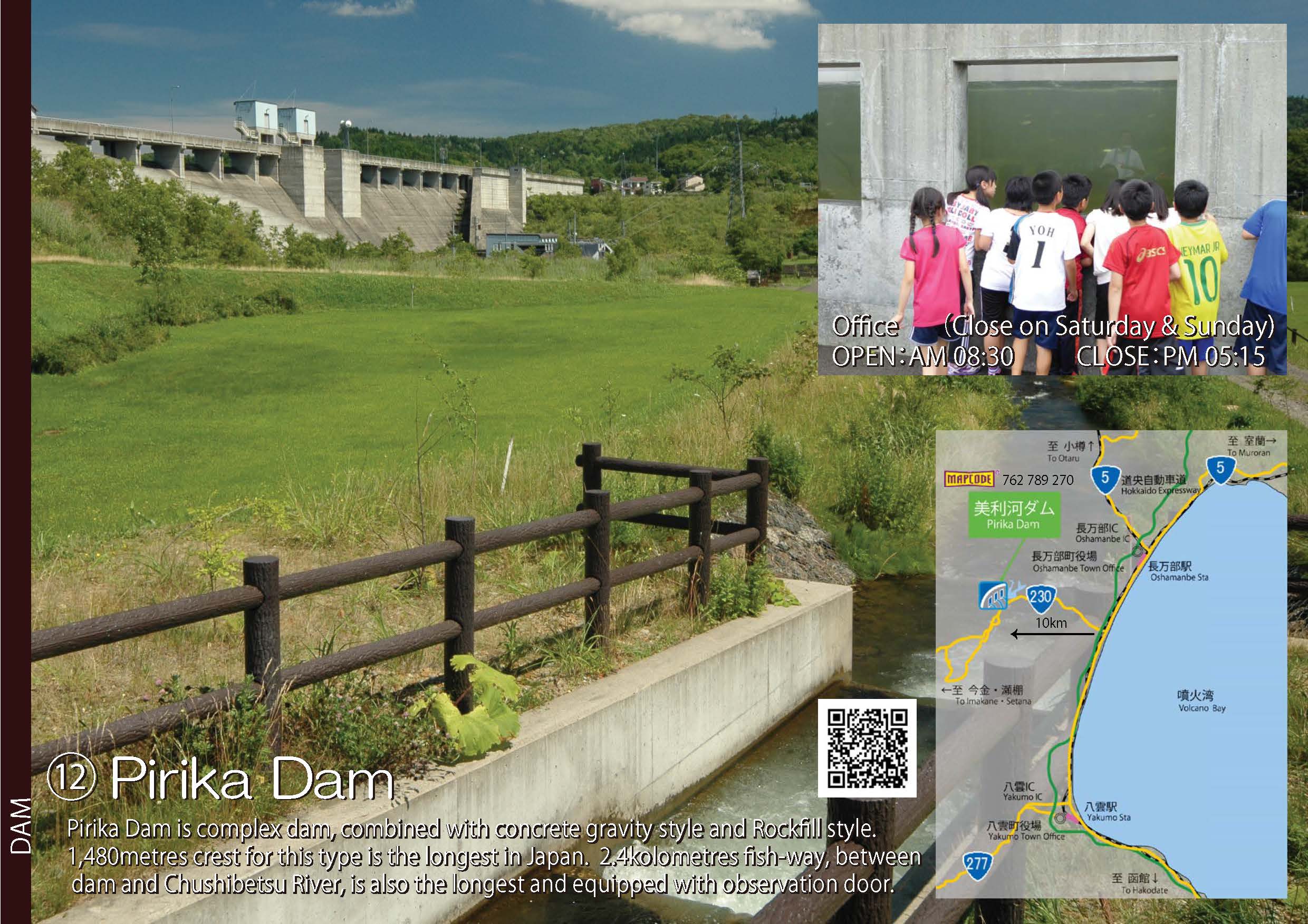
 12.Pirika Dam
-
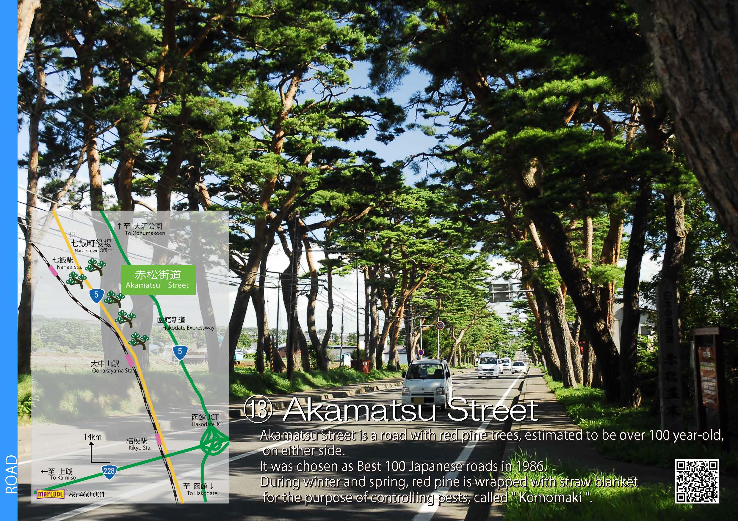
 13.Akamatsu Street
-
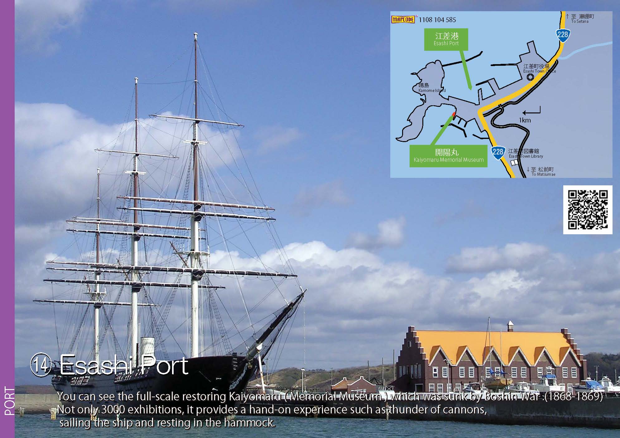
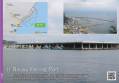
 14.Esashi Port
- 10.Mui Tunnel (JPG:315KB)
- 11.Hakodate Port & Fishing Port (JPG:272KB)
- 12.Pirika Dam (JPG:418KB)
- 13.Akamatsu Street (JPG:557KB)
- 14.Esashi Port (JPG:240KB)
-
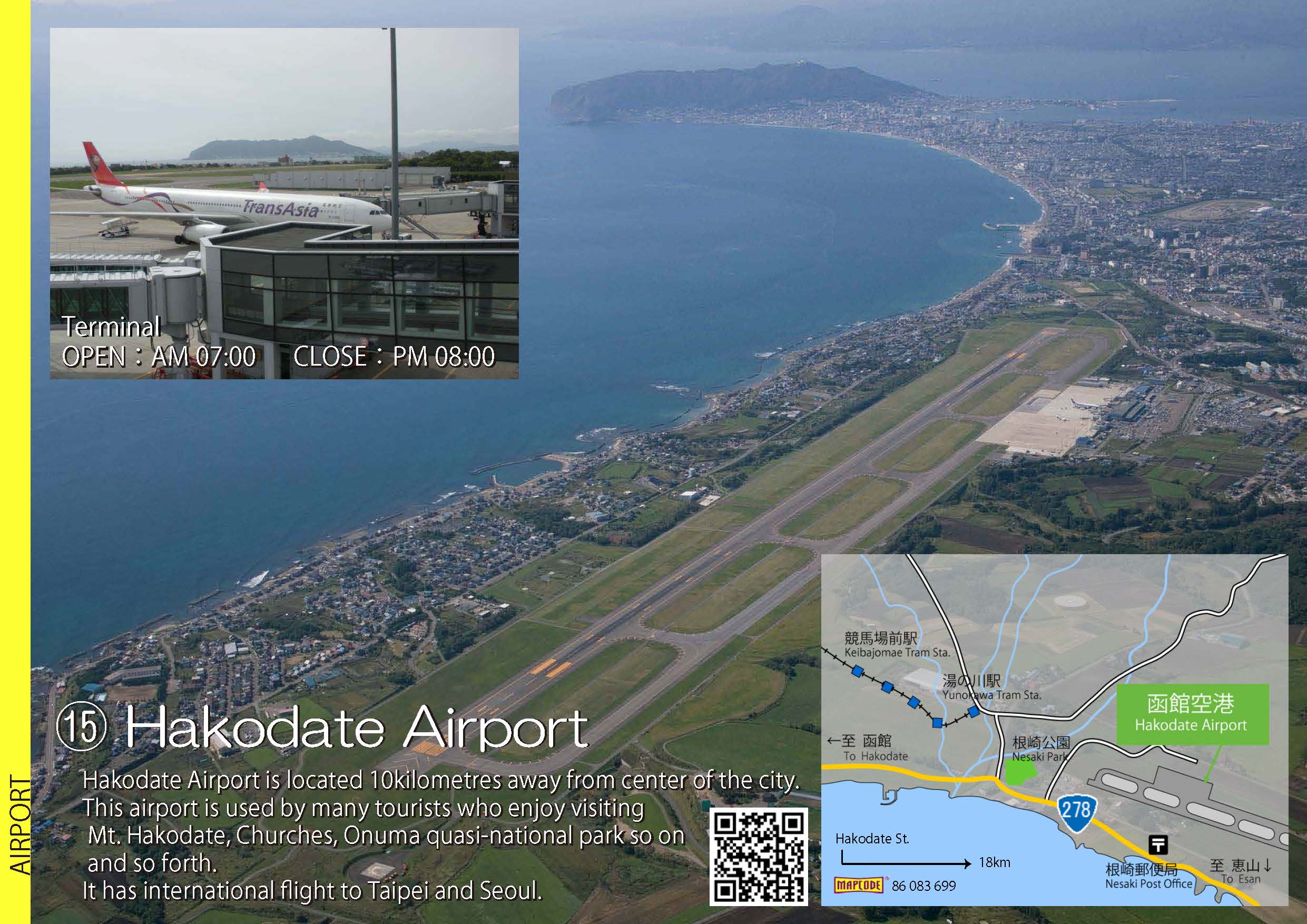
 15.Hakodate Airport
-
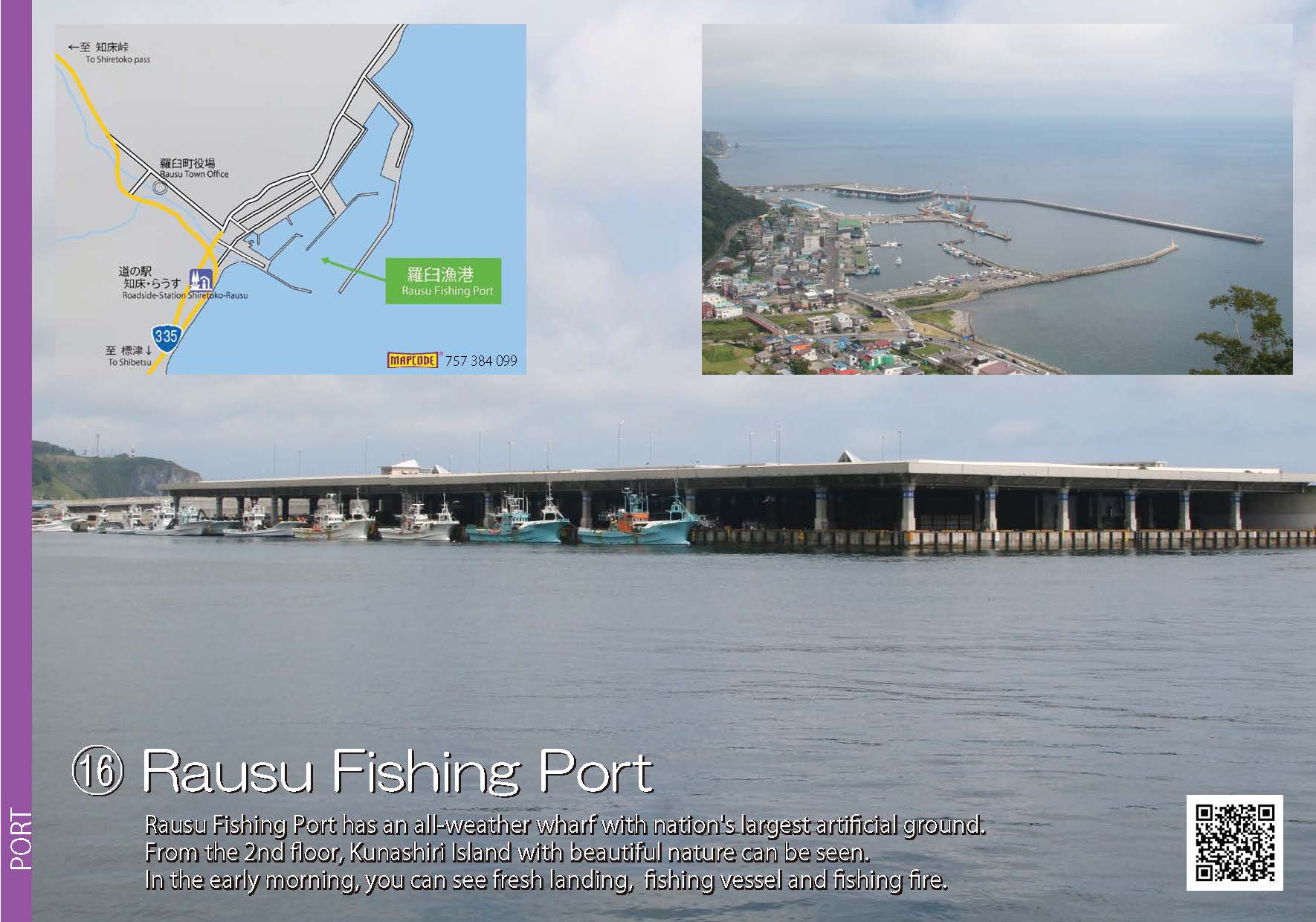
 16.Rausu Fishing Port
-
 17.Aonae Fishing Port
-
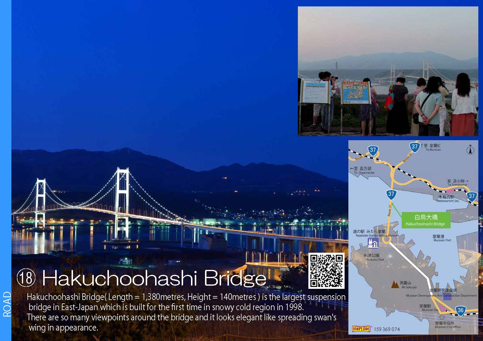
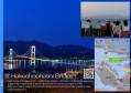 18.Hakuchoohashi Bridge
-
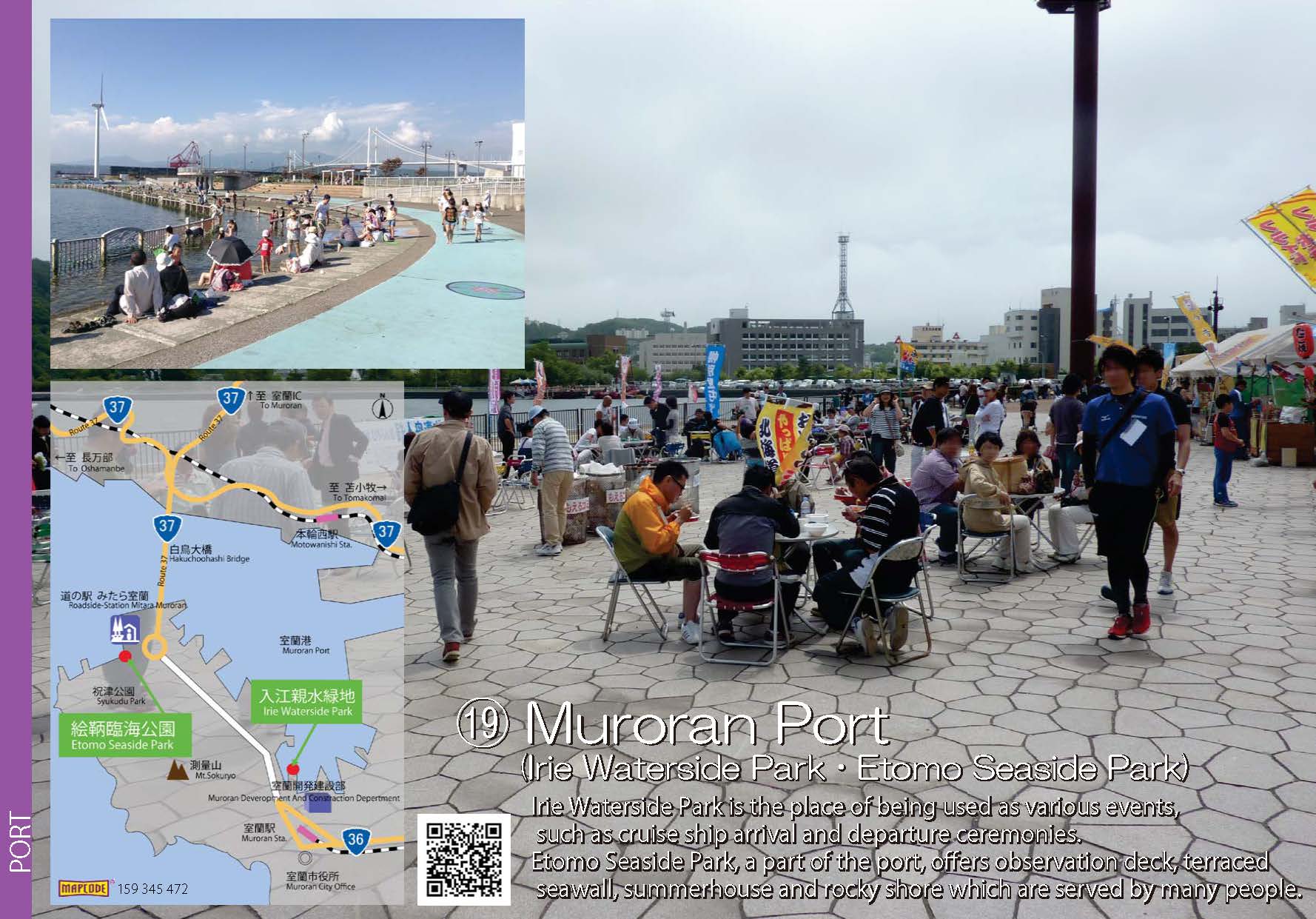
 19.Muroran Port(Irie Waterside Park・Etomo Seaside Park)
- 15.Hakodate Airport (JPG:381KB)
- 16.Rausu Fishing Port (JPG:174KB)
- 17.Aonae Fishing Port (JPG:382KB)
- 18.Hakuchoohashi Bridge (JPG:181KB)
- 19.Muroran Port(Irie Waterside Park・Etomo Seaside Park) (JPG:259KB)
-
 20.Nibutani Dam
-
 21.Tokachiohashi Bridge
-
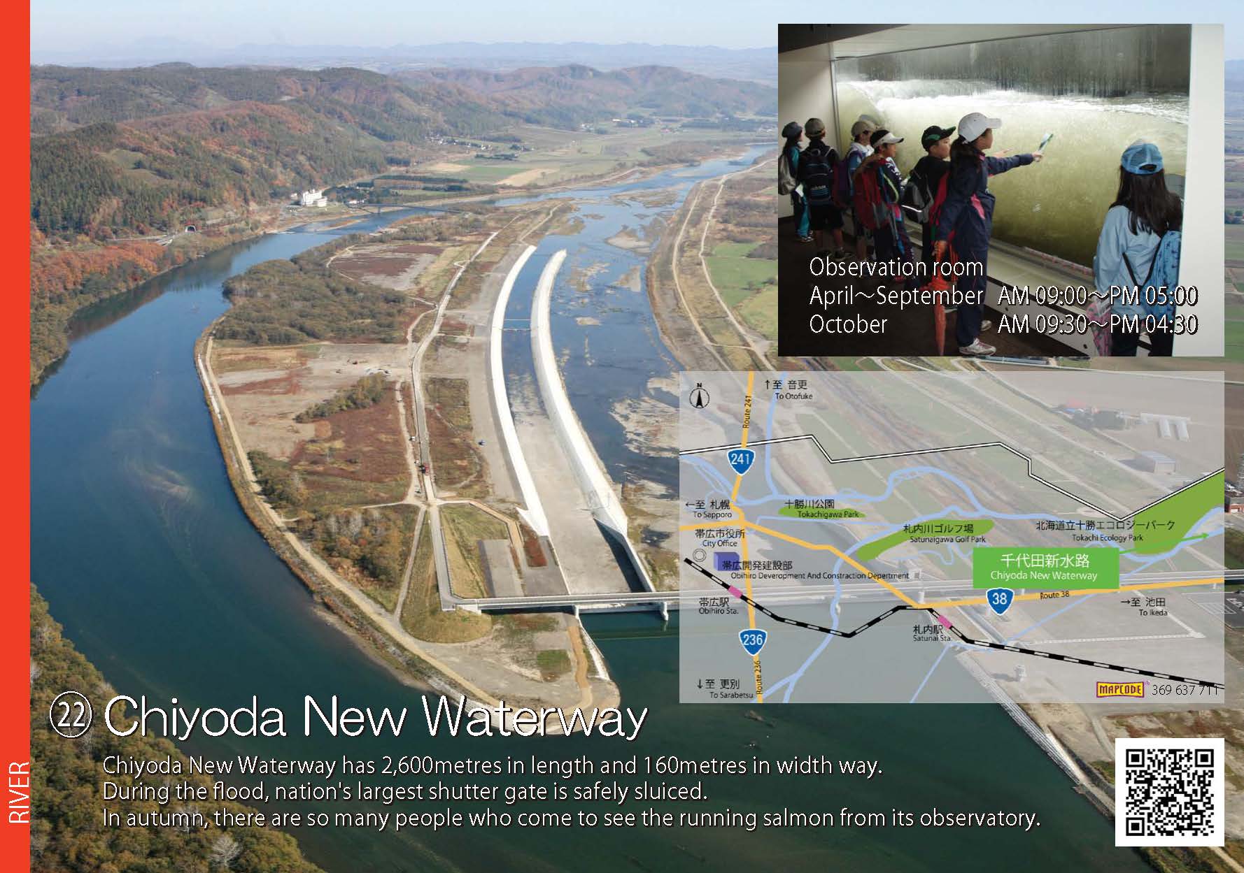
 22.Chiyoda New Waterway
-
 23.Nusamai Bridge & Earthquake-proof Passenger Ship Terminal
-
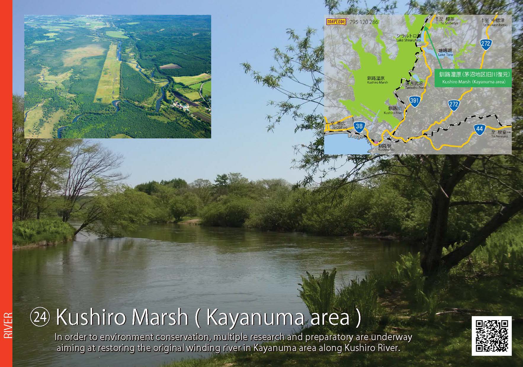
 24.Kushiro Marsh (Kayanuma area)
- 20.Nibutani Dam (JPG:244KB)
- 21.Tokachiohashi Bridge (JPG:219KB)
- 22.Chiyoda New Waterway (JPG:235KB)
- 23.Nusamai Bridge & Earthquake-proof Passenger Ship Terminal (JPG:227KB)
- 24.Kushiro Marsh (Kayanuma area) (JPG:254KB)
-
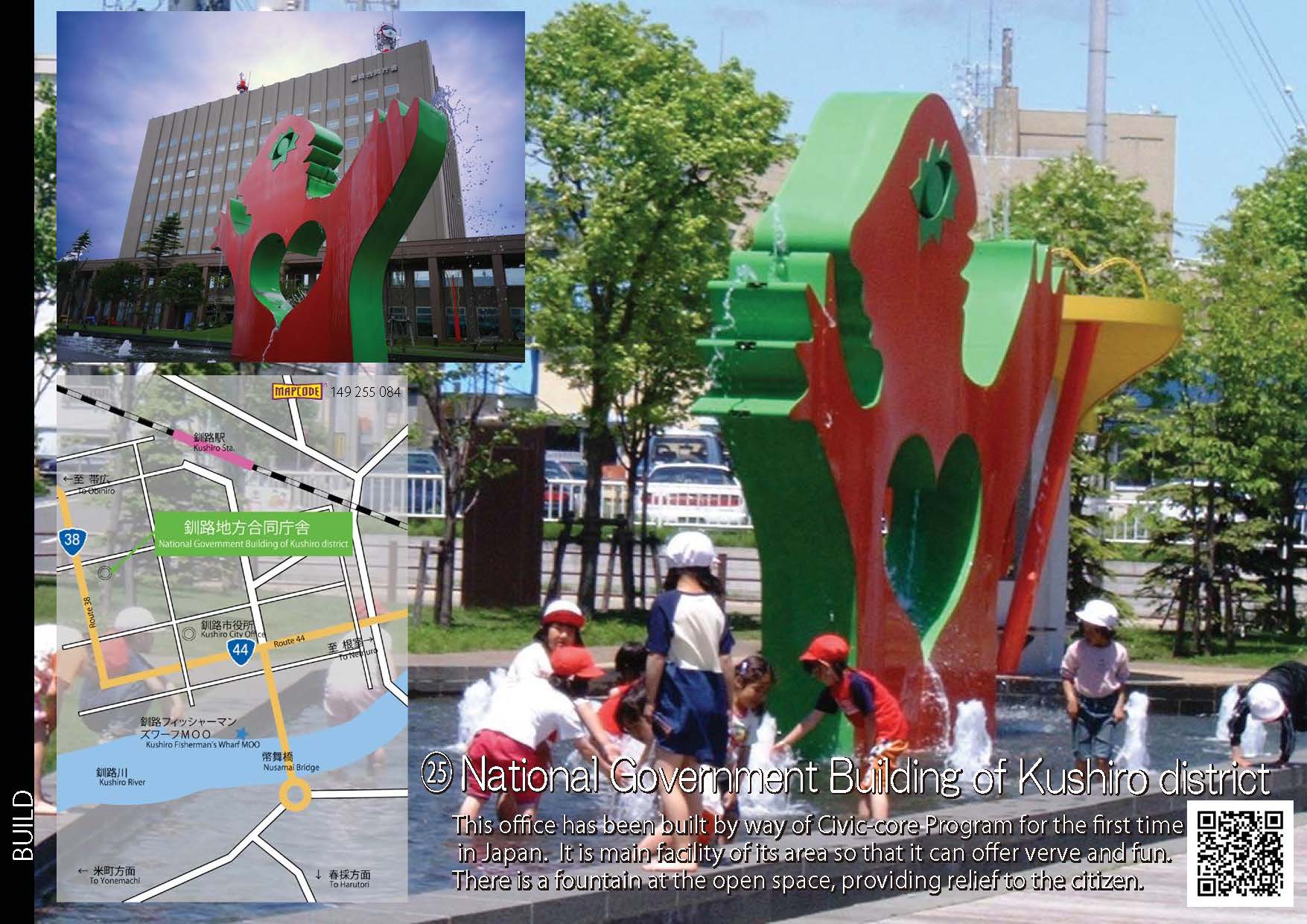
 25.National Government Building of Kushiro district
-
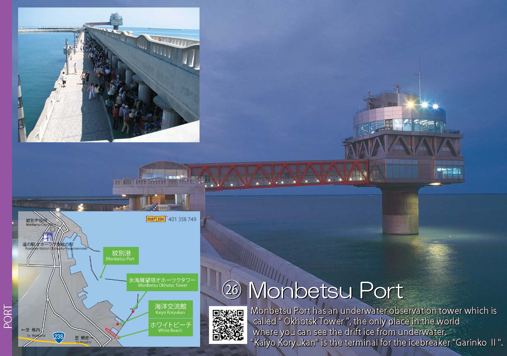
 26.Monbetsu Port
-
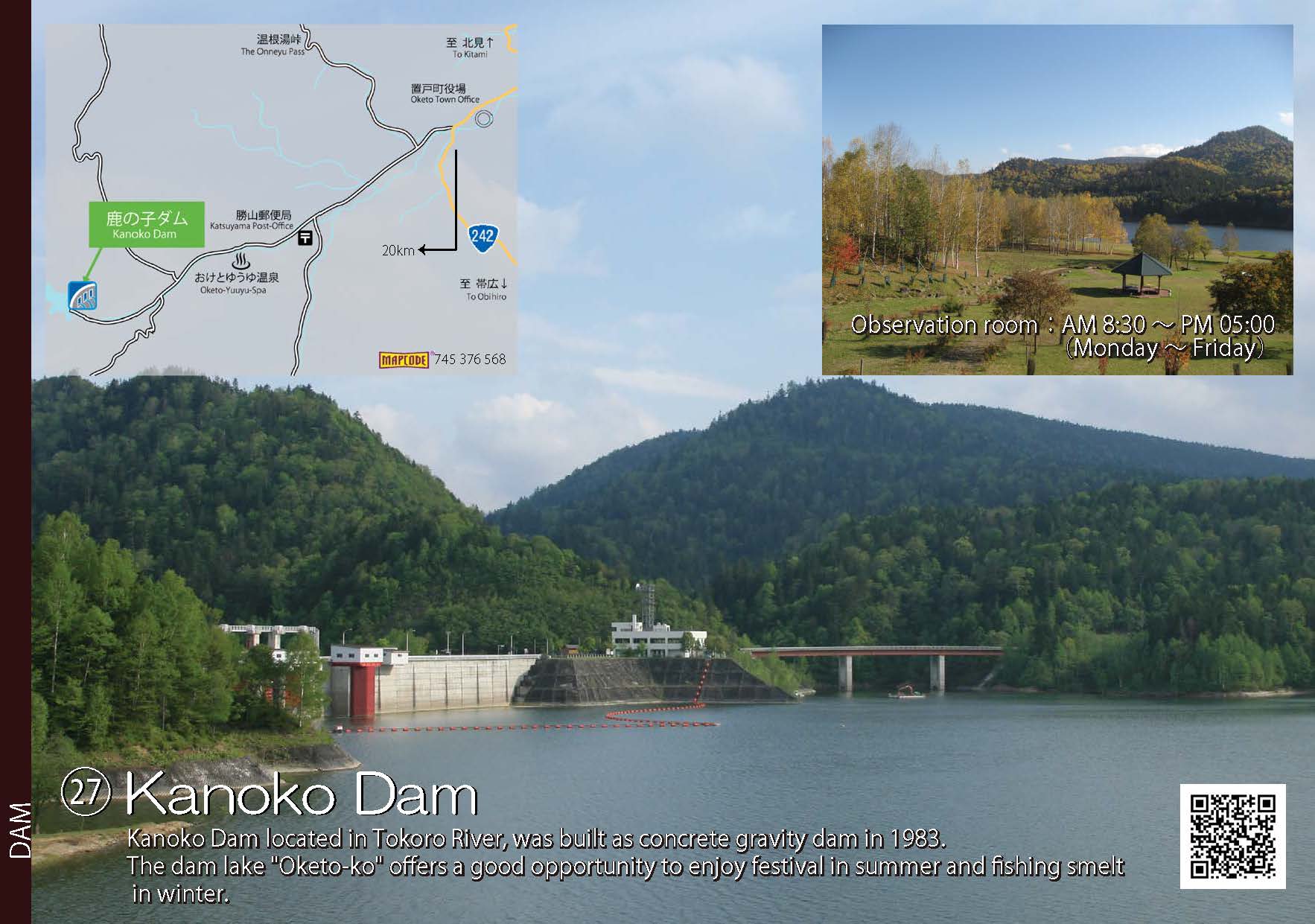
 27.Kanoko Dam
-
 28.Asahibashi Bridge & Riverline Park
-
 29.Blue Pond (Aoiike)
- 25.National Government Building of Kushiro district (JPG:253KB)
- 26.Monbetsu Port (JPG:175KB)
- 27.Kanoko Dam (JPG:190KB)
- 28.Asahibashi Bridge & Riverline Park (JPG:263KB)
- 29.Blue Pond (Aoiike) (JPG:268KB)
-
 30.Tokyo-Univ. experiment forest Viewpoint Parking
-
 31.Kitasaito Asahikawa
-
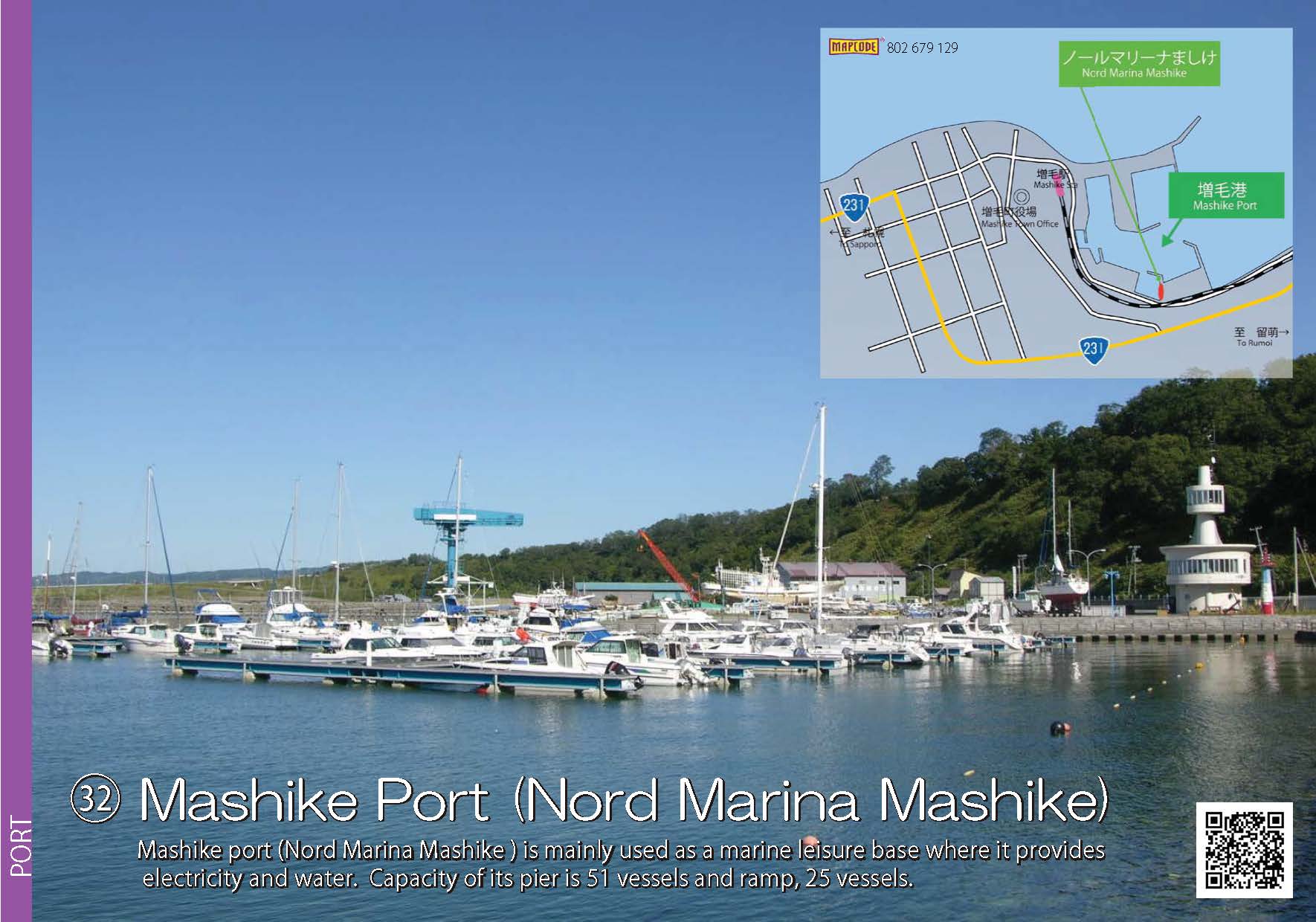
 32.Mashike Port(Nord Marina Mashike)
-
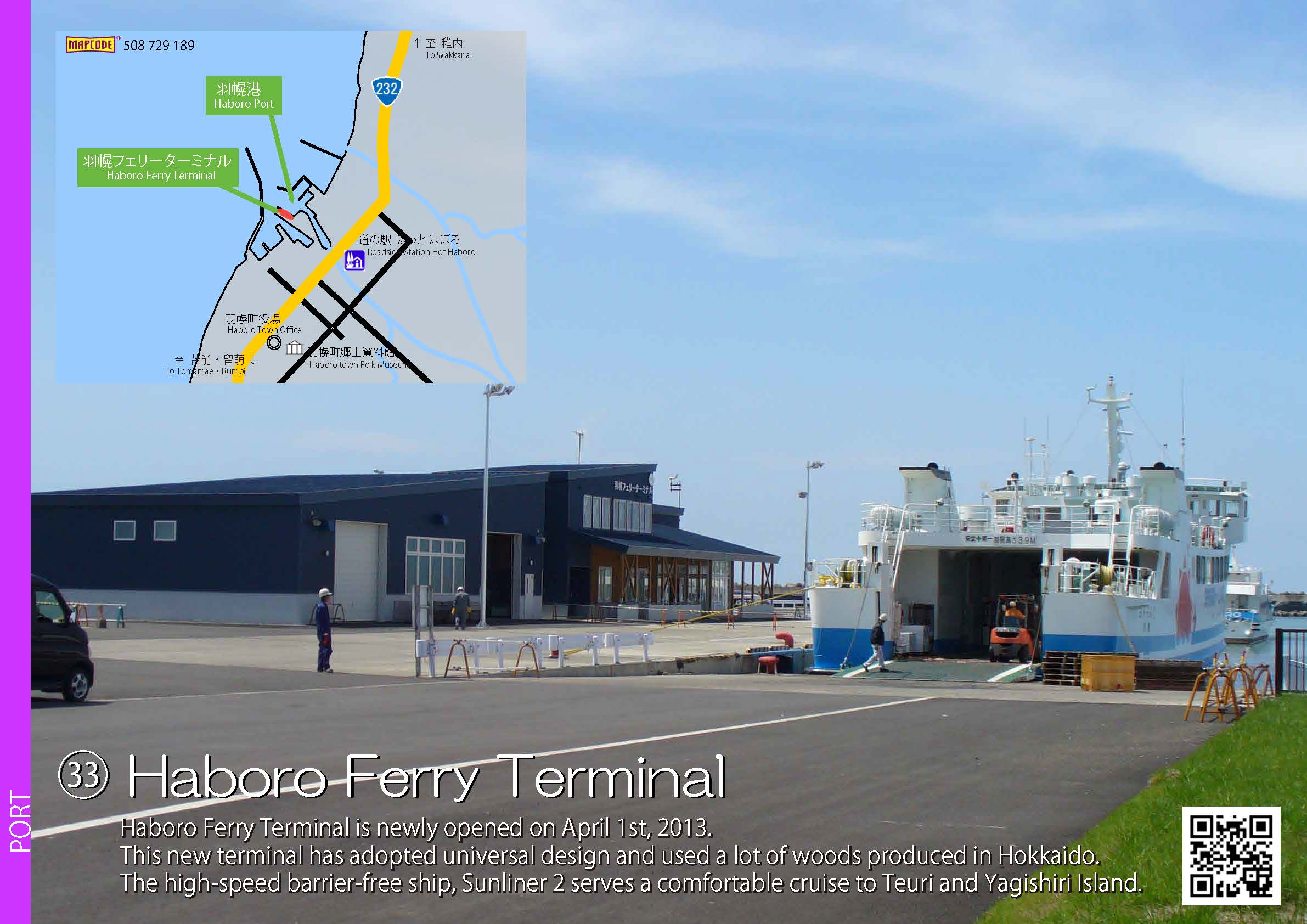
 33.Haboro Ferry Terminal
-
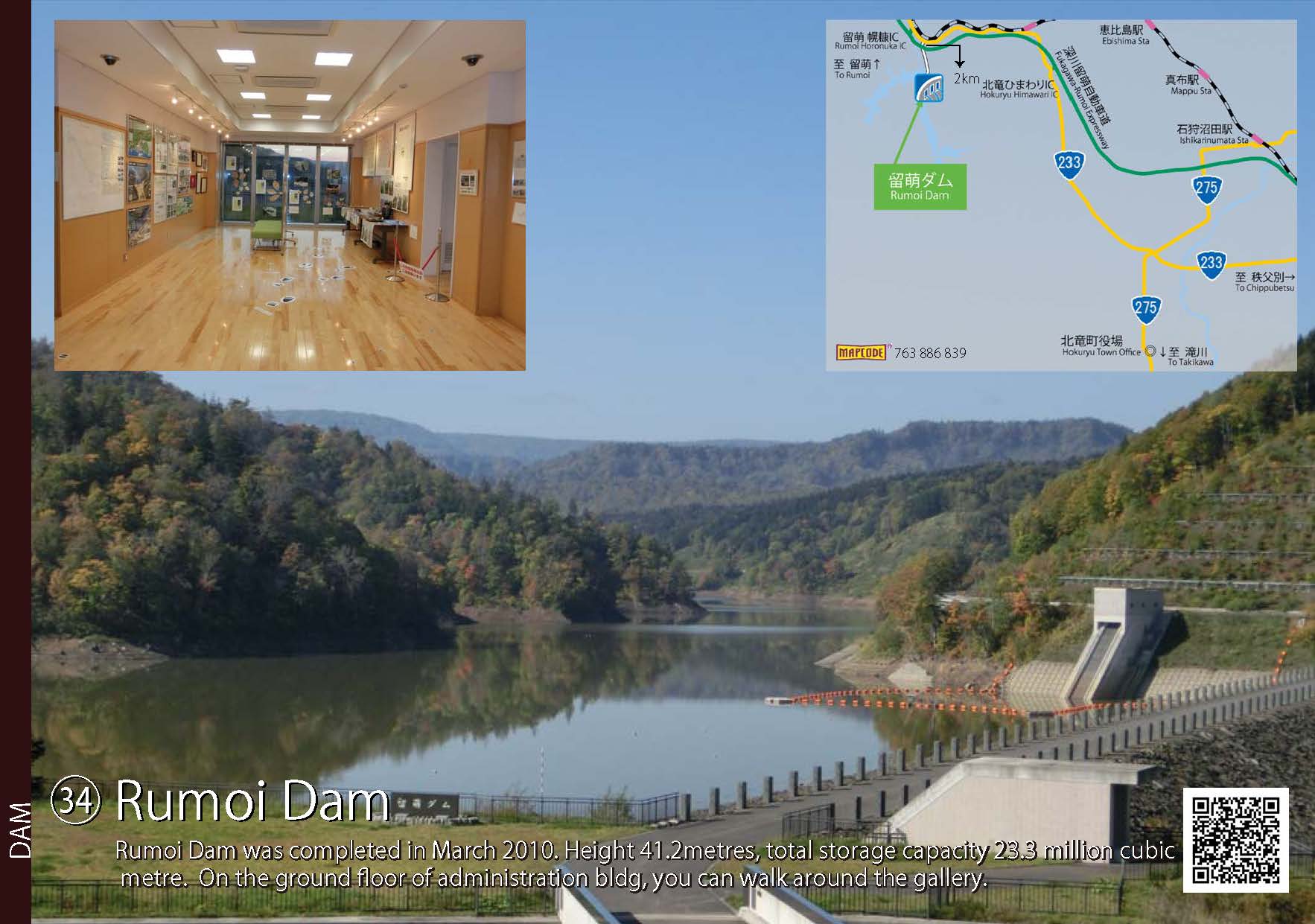
 34.Rumoi Dam
- 30.Tokyo-Univ. experiment forest Viewpoint Parking (JPG:239KB)
- 31.Kitasaito Asahikawa (JPG:293KB)
- 32.Mashike Port(Nord Marina Mashike) (JPG:198KB)
- 33.Haboro Ferry Terminal (JPG:258KB)
- 34.Rumoi Dam (JPG:186KB)
-
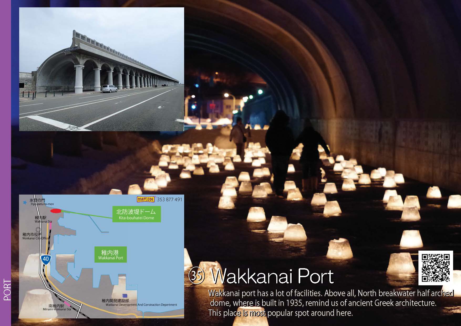
 35.Wakkanai Port
-
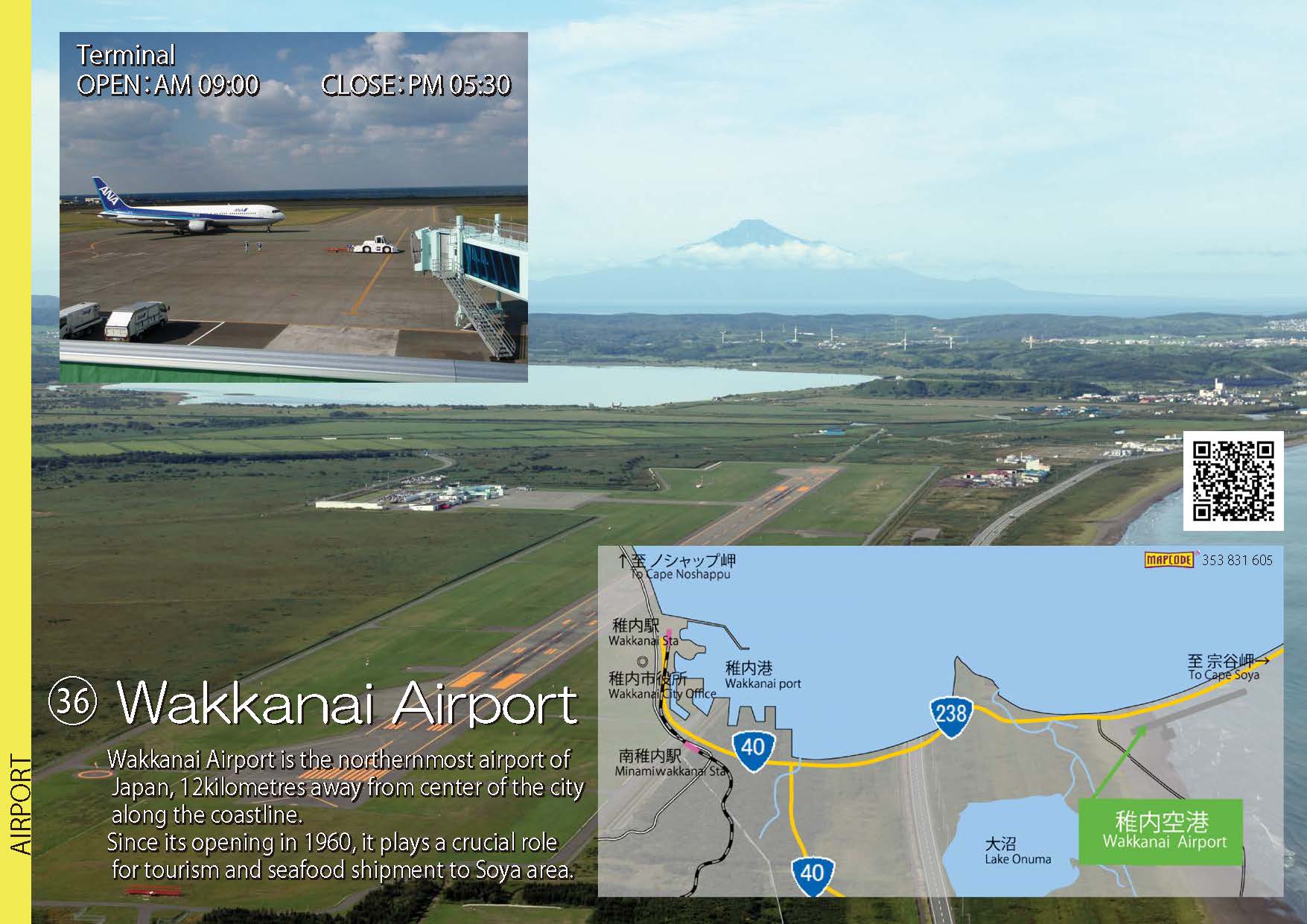
 36.Wakkanai Airport
-
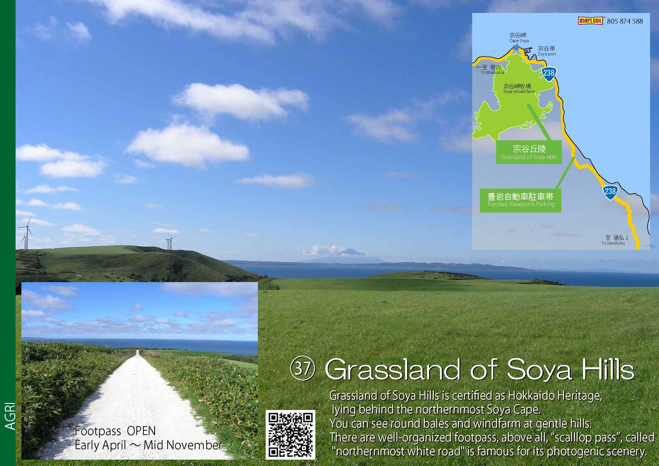
 37.Grassland of Soya Hills
-
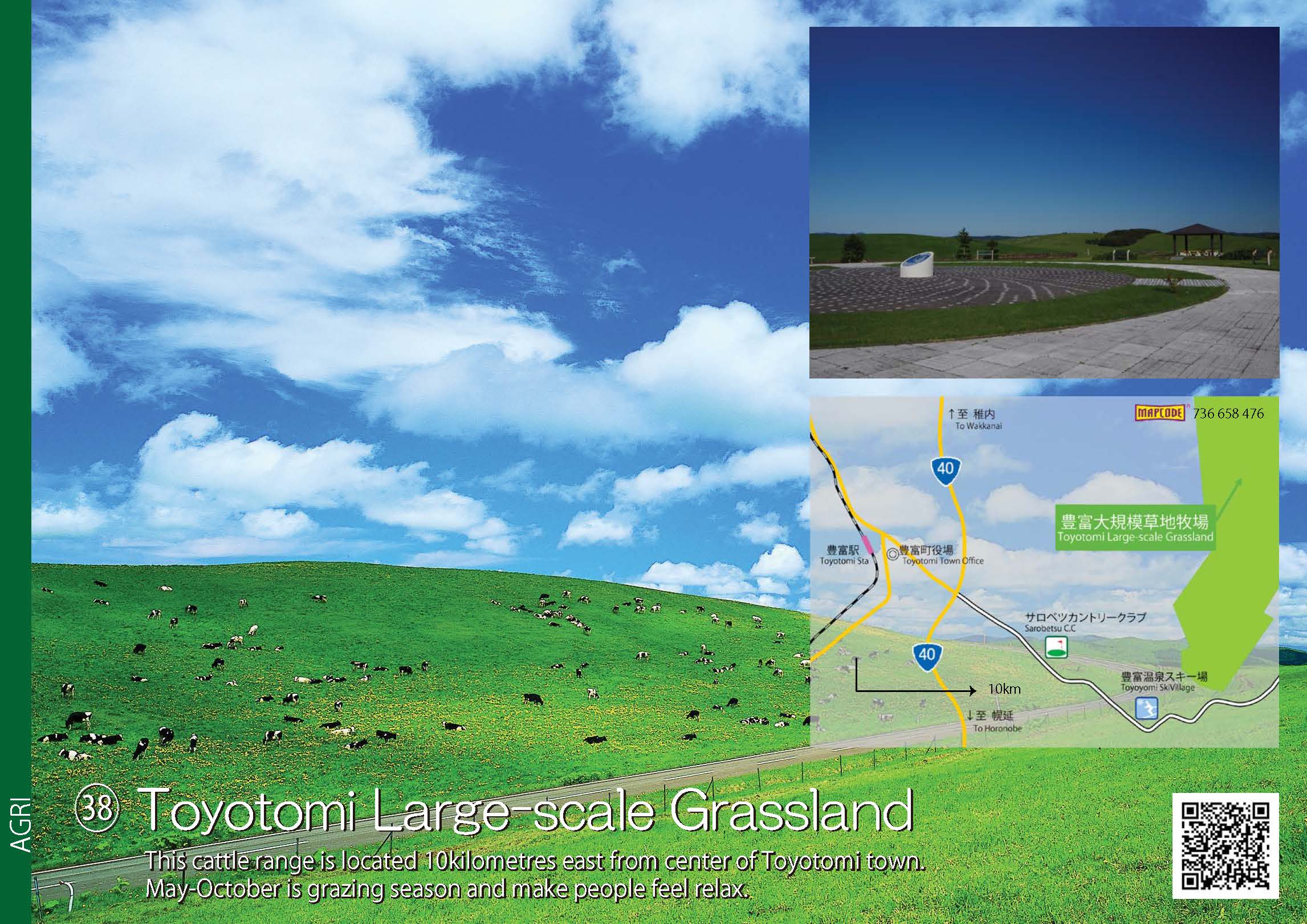
 38.Toyotomi Large-scale Grassland
-
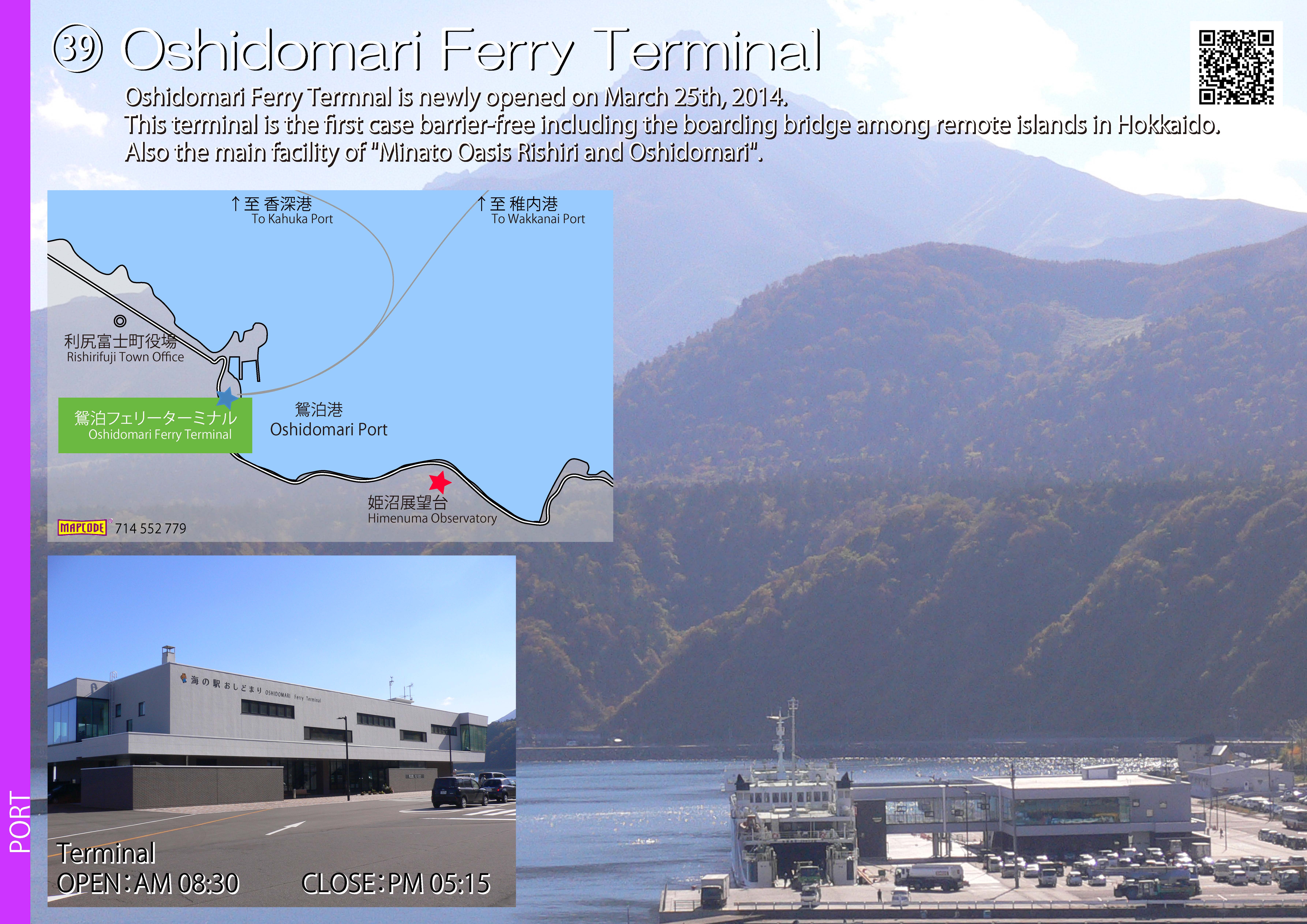
 39.Oshidomari Ferry Terminal
- 35.Wakkanai Port (JPG:166KB)
- 36.Wakkanai Airport (JPG:194KB)
- 37.Grassland of Soya Hills (JPG:293KB)
- 38.Toyotomi Large-scale Grassland (JPG:418KB)
- 39.Oshidomari Ferry Terminal (JPG:1.77MB)
-
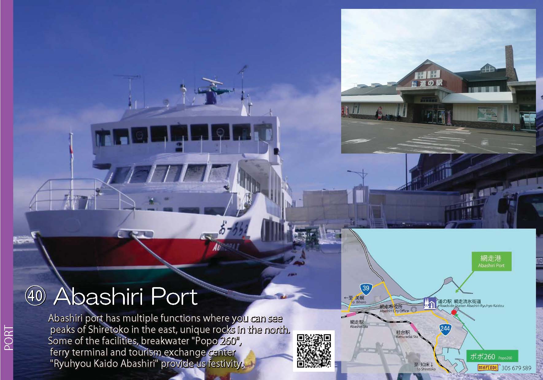
 40.Abashiri Port
-
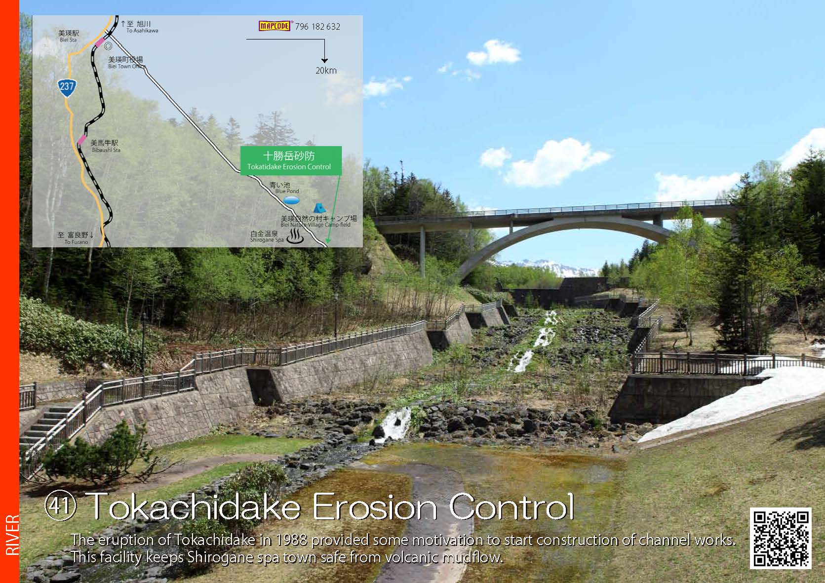
 41.Tokachidake Erosion Control
-
 42.Bifuka Island
-
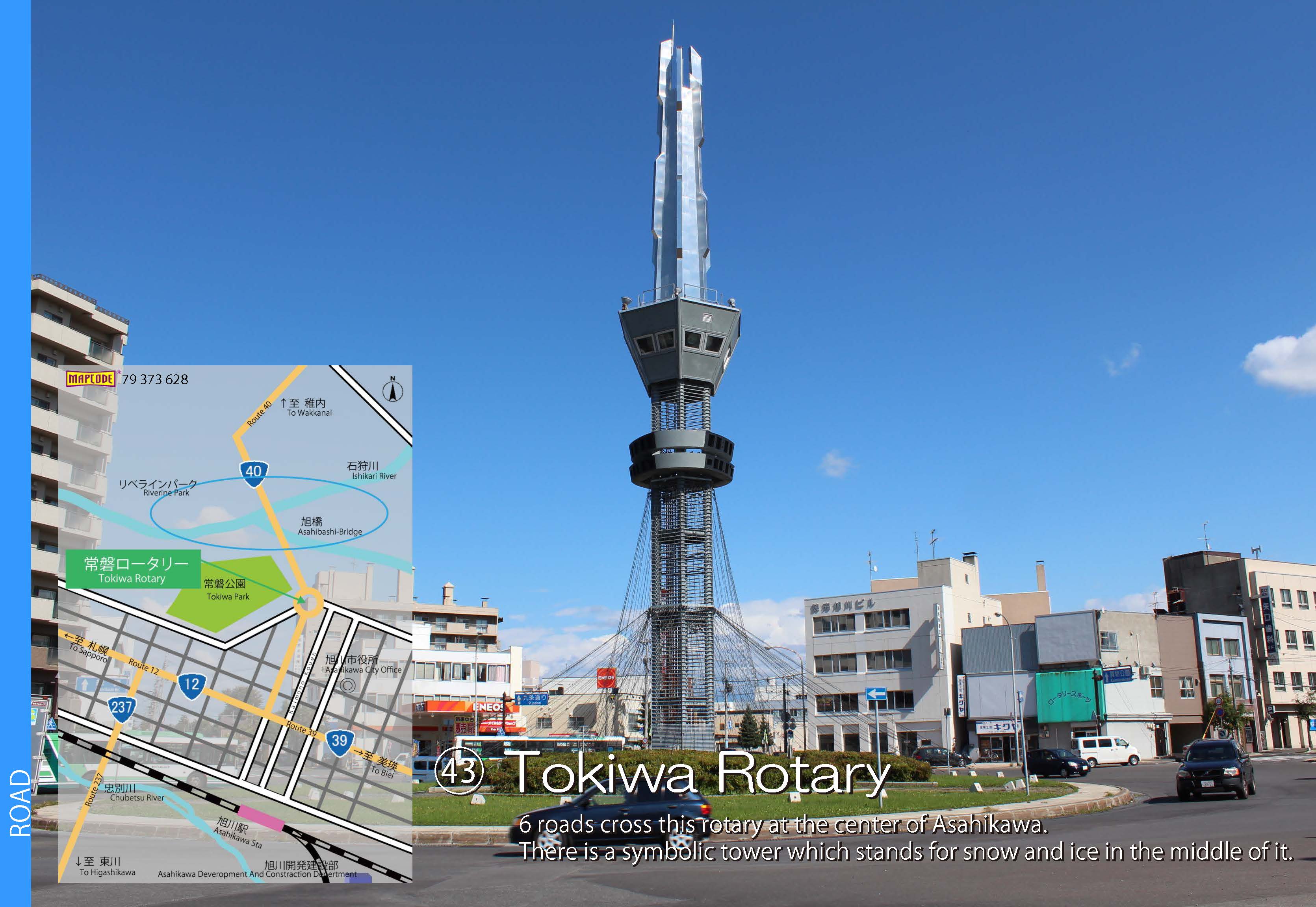
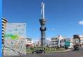 43.Tokiwa Rotary
-
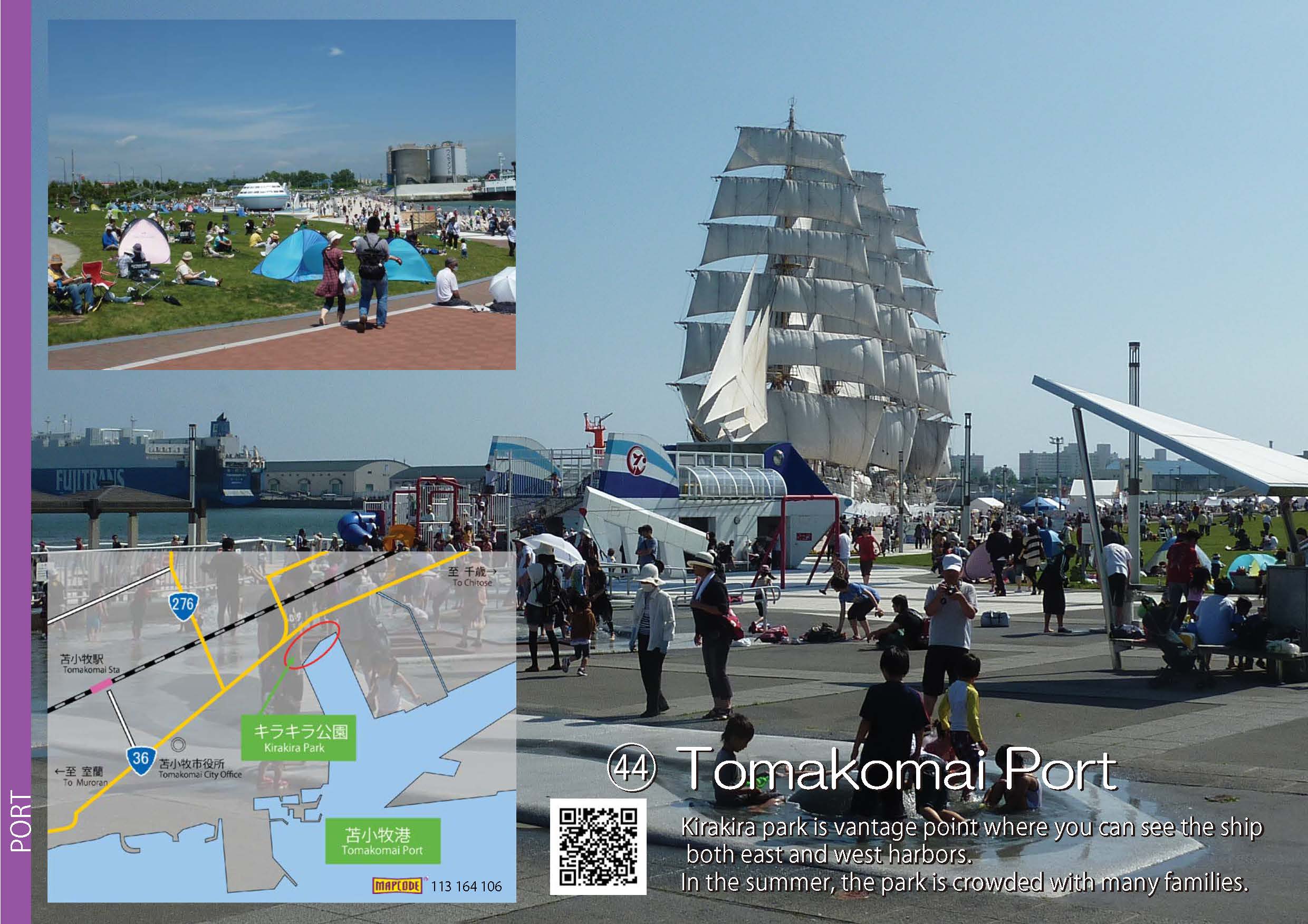
 44.Tomakomai Port
- 40.Abashiri Port (JPG:177KB)
- 41.Tokachidake Erosion Control (JPG:248KB)
- 42.Bifuka Island (JPG:270KB)
- 43.Tokiwa Rotary (JPG:479KB)
- 44.Tomakomai Port (JPG:339KB)
-
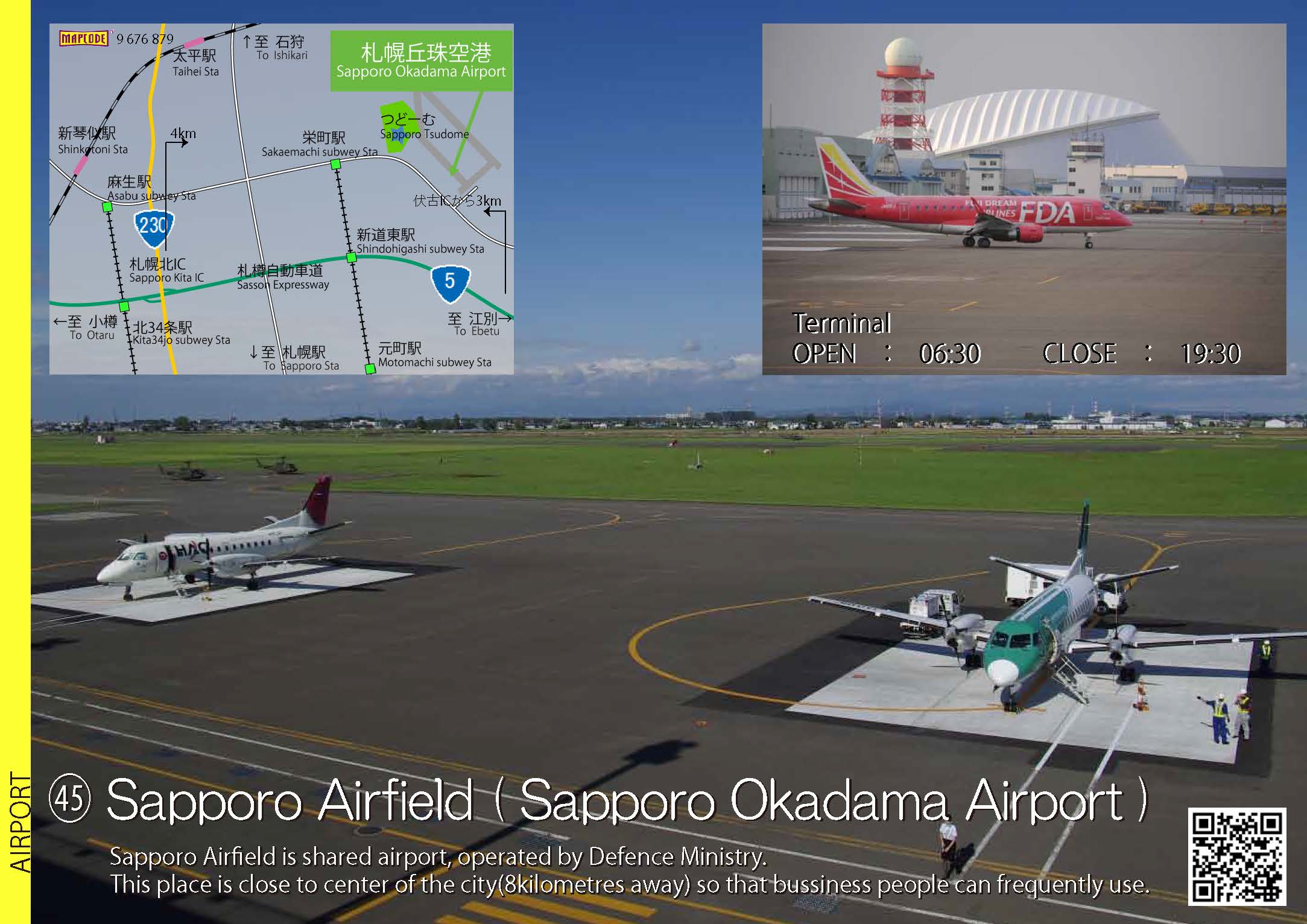
 45.Sapporo Airfield (Sapporo Okadama Airport)
-
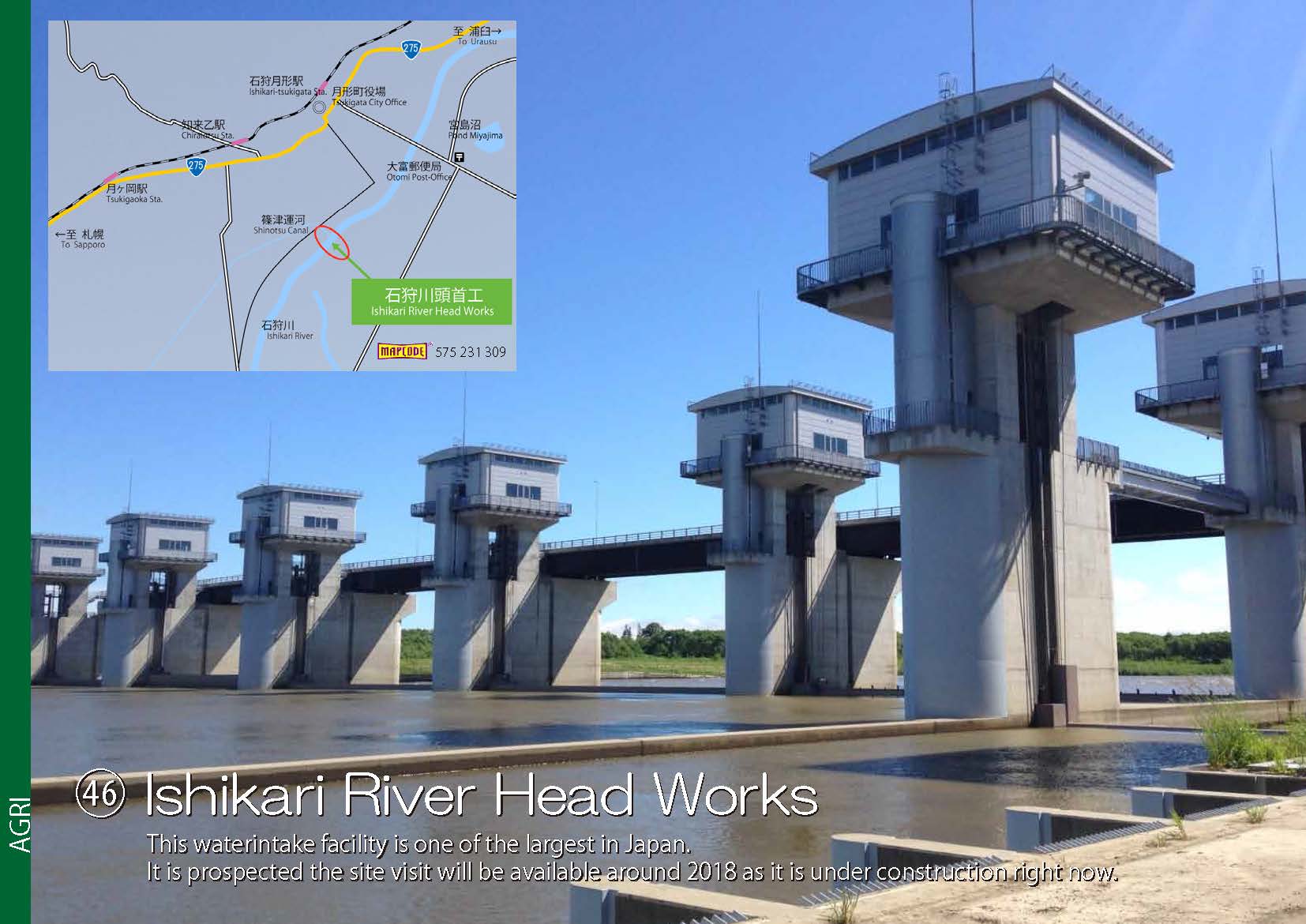
 46.Ishikarigawa River Head Works
-
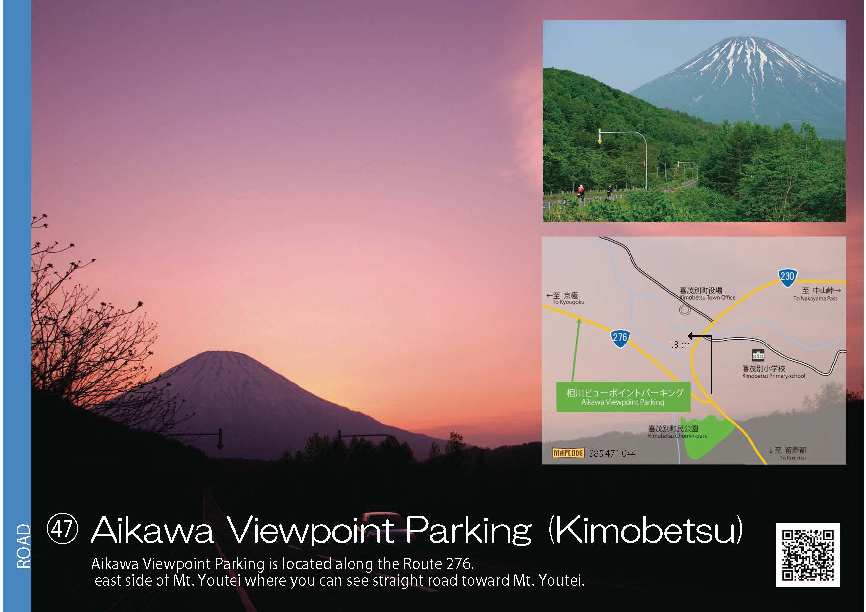
 47.AikawaViewpoint Parking
-
 48.Oinaoshi Fishing Port
-
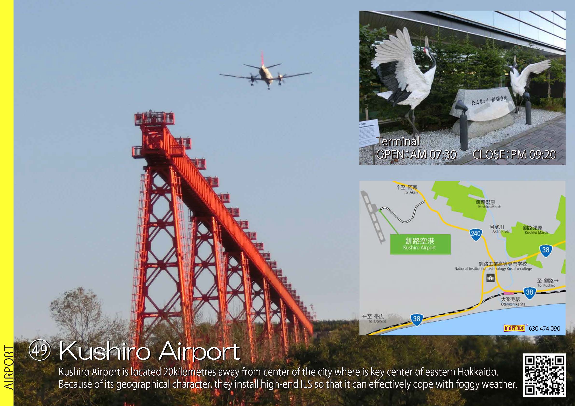
 49.Kushiro Airport
- 45.Sapporo Airfield (Sapporo Okadama Airport) (JPG:253KB)
- 46.Ishikarigawa River Head Works (JPG:163KB)
- 47.AikawaViewpoint Parking (JPG:153KB)
- 48.Oinaoshi Fishing Port (JPG:193KB)
- 49.Kushiro Airport (JPG:297KB)
-
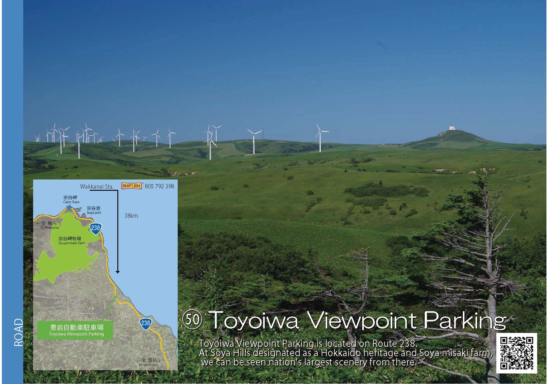
 50.Toyoiwa Viewpoint Parking
-
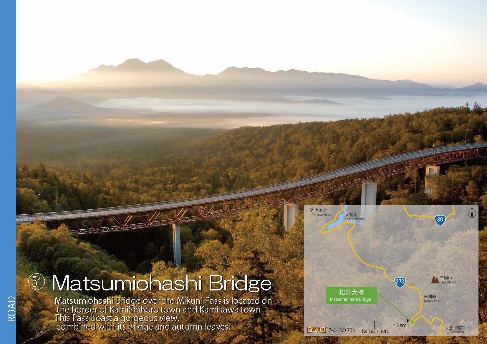
 51.Matsumiohashi Bridge
-
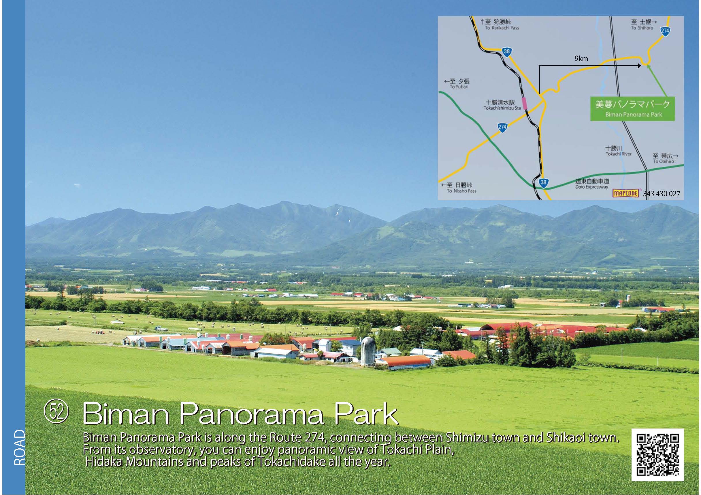
 52.Biman Panorama Park
-
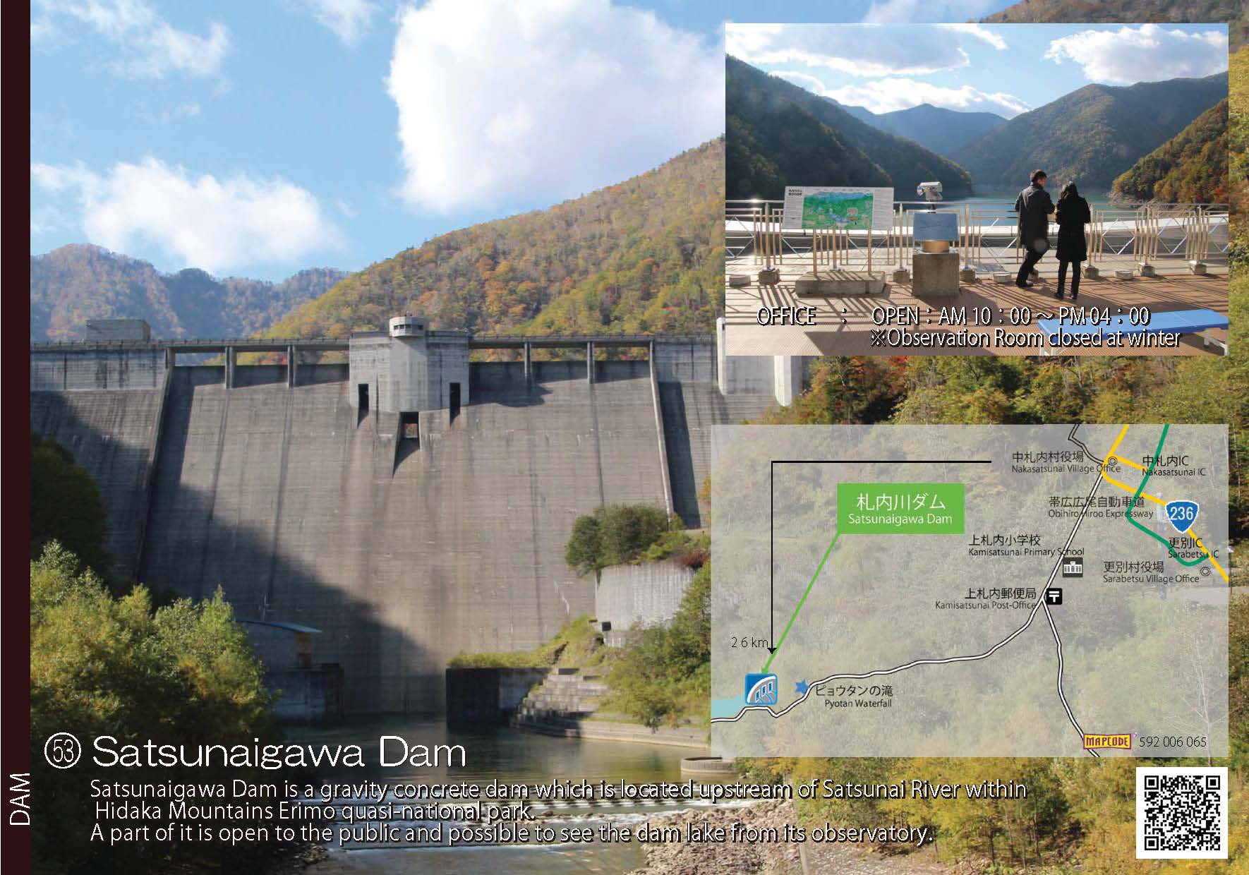
 53.Satsunaigawa Dam